Wednesday 28 August 2013

The P 13 Route

Wednesday 8 May 2013

This, Mary’s and my second bus of the day, departed from the Bus Station which nestles under the wing of the pending Streatham Leisure Centre.  Unlike our first bus, the G1, this one rolled from its resting place right on time and we were off by 11.55.  It was again a single decker with only one door, and was going to take us to the big Sainsbury’s at New Cross Gate.

We headed up through Streatham, passing a range of shops, varying from the plebeian to the smart, but all interesting, and past the Odeon Cinema, as well as the Leigham Practice, whose promise is ‘restoring balance’. 


Then we turned right along Downton Avenue, and were into Tulse Hill, with lovely small semis, mostly boasting attractive porches.  Hillside Road took us to Hillside Gardens, and the end of Alice’s road, and then we came to Pizza Godfather, with the logo showing the godfather’s hand operating puppet strings of the letters.


 Tulse Hill turns seamlessly into West Dulwich, and we passed the Trevor Bailey Sports Ground, which proves to belong to Dulwich College, the large private school which owns a lot of property round here.  We also passed Dulwich Stables, whence comes the manure for Mary’s allotment.  Then we turned left up Underhill Road, with excellent views of Crystal Palace to the right, and reached the graveyard at the top of the hill, before heading down again.  We were the only bus along here, until we reached the shopping streets, to admire the fine butcher’s shop of William Rose.  We also passed the Lord Palmerston pub and a couple of shops raising money for St Christopher’s Hospice The Bishop Pub had a chess piece for its sign, thus avoiding any accusations of disrespectfulness, we thought.

Next, we took a turn into the massive Sainsbury’s of East Dulwich, and  then passed through the large blocks of public housing along Lordship Lane before once again moving into streets of terrace houses.  I was amazed by the topiary of Bellenden School and then Mary pointed out her favourite book shop   This is very much Mary’s neck of the woods. 


 I had not quite grasped that both Dulwich and Peckham lie between Streatham and New Cross, so it was all extra interesting to me.  We passed the mammoth Harris Peckham Academy, and were interested to see that it includes a Free School:  yet another tax-payer funded establishment which is exempt from Gove’s National Curriculum.


Past Persepolis, emporium of wonderful Persian foods, and Peckham Pulse and the Library, we went into and out of the bus station with barely a pause.  And then we passed Queens Road Station, and were into New Cross, noticing the out of date politics of the fire station’s signage, before turning into yet another huge Sainsbury’s, to finish this South London journey at  12.55:  not exactly the 42 minutes suggested on the bus stop, but that may have been because we experienced a bit of a diversion around Bellenden Road.


The P12 Route

Surrey Quays Shopping Centre to Honor Oak Park
Monday March 16th 2009

Glorious spring day with temperatures in the teens so floor level heating in the bus seemed a little superfluous. It arrived at the stop before I had a chance to capture the moment and was off happily through the very many estates of Southwark – in part retracing the Number 1 but then veering more south-west round the Millwall football club.  This area, squeezed between all the railway lines is somewhat bleak industrial – paints – pumps – pallets and the like till you get to the more colourful Peckham, boasting peppers and chillies in bright colours. Being 3.00 PM or thereabouts most of the passengers were primary school parents and their charges from the schools named after local heroes – John Donne and Pilgrims Way. The two large secondaries were more business-orientated being Harris and City of London academies. After Peckham the bus starts climbing through Nunhead with the only drama a run-in at a roundabout where a lorry left us (a mere single decker) no room to turn ‘knock his wing mirror off’ yelled a passenger – ‘he doesn’t give a b****r about us’ – sense prevailed and we finished at the head stop beyond Honor Oak Park station – home for this one.

PS As you can see I rode this route, without companion or camera in about the third week of the Project’s start back in March 2009 before we had really got into this blog thing. I had joined the Project for Route Number 3 and as I spent my school commute on Route 2 did not feel compelled to repeat it but did ride the Number 1 alone, then taking the P12 home. The photos date variously from subsequent travels and are from a phone camera.

August 2013: There have been changes – if you really wanted to get from one end of this route to the other the Overground will do it for you in a quarter of the time – 12 minutes as opposed to 60 plus. The first big loop round from Surrey Quays Shopping Centre to Canada Water always feels a bit like going back on yourself.  Clearly the poor little P12 is not allowed to play with the big boys at the Canada Water Bus Station but is relegated to waiting in the outdoors by Surrey Quays Shopping Centre.

There has been much building in the intervening four years, including a brand new library for Southwark just by Canada Water train and bus hub. It’s as lovely inside as out with excellent views. 


Old and new alternate along this route with several of Southwark’s older mid-20th century estates, erected in haste to house the post-war homeless and then the later ones built with half an eye of being ‘sold off’. Although the P12, along with some other routes, follows Southwark Park Road you do not get a very clear view of what is quite precious green space along this route. It’s more a case of crossing or running parallel to railway lines - 
It was ever thus – even before the railways there were horse depots and horse hospitals with still stables remaining – we were mocked by Russell Howard on his Good News show about a year ago but to find horses (and thus horse manure) in such a built up area does seem startling. Between the main trunk roads the route can be quite peaceful and Caroline Gardens by Asylum Road, used in the sense of safe abode rather than its more modern meaning of residence for the psychiatrically unwell, has some very attractive buildings.    For fans of almshouses there are more to be seen later on the route once past Peckham and into Nunhead.

The pride of Nunhead is undoubtedly the cemetery; the P12 does not actually pass the gate, but you can easily walk through some of Nunhead’s quieter streets for an alternative approach route.

Along Brenchley Gardens the P12 does give direct access to both the Camberwell New Cemetery and the adjacent Honor Oak Crematorium. It’s quite a common sight to see black-clad mourners pelting out of Honor Oak Station to stand frustrated at the bus stop opposite – it is only a 12-15 minute service which is enough time to miss the funeral slot…and you cannot just hail a passing taxi…so leave plenty of time.

At the risk of repeating the P4 lost river theme much of this route follows the Lost River Peck starting as it does up on One Tree Hill and finishing where Surrey Quay meets the Thames.
(A nice website if you like things watery…)

Last year the P12 got a whole new fleet of buses with capacious standing capacity above the 38 seats so I feel, in spite of the fact the Overground does it quicker, there is still a bright future for this route.


Tuesday 20 August 2013

The P5 Route

Thursday 15 August 2013

When Linda and I penetrated the depths of the Patmore Estate, there appeared to be two P5s awaiting us; but one had broken down, and the other had just arrived as a replacement. The amiable driver let us on, which was kind, as Linda had hurt her knee climbing down the startlingly steep step off the train which had brought us to Queenstown Station. 

The bus starts in an area where light industry and storage meets housing. Linda and I remember when Aussie Man and Van was the small business its name implies!

At 11.42, we were off, heading for Elephant and Castle.  Well, that’s a bit of an overstatement, as we headed in many different directions before arriving at E and C.  If Watson and Crick had used the P5, they would have been inspired to think of the Double Helix of DNA much more quickly.
 We wiggled through the Patmore Estate, passing Sir James Barrie School (I don’t think he ever came near this area, being a Kensington Gardens and Great Ormond Street person) We turned onto the Wandsworth High Road and now began to have some company on the bus.  A little collection of Portuguese and Brazilian eateries caught our eye before we turned right down Landsdowne Road.  We were not sure which way we were facing, so were pleased to reach the landmark of Stockwell’s fine bus garage (unlike this blogger we have never been inside it, though we have been into the Streatham garage). 

We noted with interest that there was a 24 bus parked in the garage.  Odd, because this is nowhere near either Pimlico or Hampstead, the ends of the route which boasts Boris’s vanity bus (nicknamed by Diamond Geezer -but use his index to find the post about the bus - ‘the Roastmaster’ for its failed, though very costly, cooling system)
 I mention the Mayor only because we were about to come to another failed vanity project, the so-called cycling superhighway 7, which, as you can see from the picture, provides a safe and uninterrupted route for cyclists (not).


 We liked the mother and child statue, which dates from 2008, and also paid our respects at Stockwell Station to the memory of Jean-Charles de Menezes, murdered by the Metropolitan Police.

Heading on towards Brixton, we came to the Acre Lane Almshouses, emblazoned with the words ‘built and endowed by Thomas Bailey’, and the date, 1822, and then we were passing Lambeth Town Hall to reach Windrush Square. 

As we negotiated the one way system, we could see signs of the changing population of the area, though there is still the Ultimate Jerk Centre as well.

Now we turned into the Loughborough Park estate and passed the Evelyn Grace Academy, with the amazing buildings designed by Zaha Hadid. I’m not able to discover who Evelyn Grace was, however.  The Loughborough Estate is run by the Guinness partnership and we continued through it to reach the Shakespeare Business Centre, clearly less prosperous than it once was.  

 This is the area where Oval Quarter is being built , a huge development though of course not owned by the public , unless the public are people who can afford a quarter of a million pounds for a one bedroom flat.  The building works meant our bus driver had to squeeze skilfully through very narrow spaces.  We came out into the Camberwell New Road, passing signs to the Blue Elephant Theatre

St Wilfrid’s is a Catholic Church, named for a British saint who was instrumental in ensuring that Christianity in Britain became Roman not Celtic.  

  
Turning left into the Walworth Road, we spied East Street Market, where Ed Milliband recently had an interaction with an egg.  But we also noticed the very up-the-road grocers,  G Baldwin and Co.
The building that houses Newington Library is part of a health centre complex that dates from the 1930s and shows it with a quote from Cicero above the entrance. 


Finally, we admired the new and improved road layout of Elephant and Castle’s complex junctions, and passed the Northern Line Station and the shopping area, to terminate at 12.30. 


This had been mainly a visit to the extensive and varied public housing (and ex-public housing) schemes from Wandsworth, through Lambeth and into Southwark.  It was like a history lesson about how politicians used to provide for the basic needs of the people.

Monday 19 August 2013

The P4 Route

Lewisham Station  to Brixton Station
Thursday August 15th 2013

It’s a big leap from K to P but N of course stands for the night buses, which we are not covering. P stands possibly for Peckham, though this route goes nowhere near Peckham (you will have to wait for the P12 for that) and also does not operate out of Peckham Bus Garage: it has been seen scuttling into Catford Bus Garage.
This is the one bus I could have written without leaving my bed – we have been living on its route for 30 years and have seen it through its various phases.  Our understanding had always been that the Dulwich Estate, previously known  as Alleyn’s College of God’s Gift, was a rather picky landlord (there were rules such as not having your laundry out on two consecutive days or any Sunday, and if your garden got too weedy they sent you letters pointing this out too) and did not like buses running through its land, but eventually agreed on a little Hoppa-type vehicle, which is how the P4 route started in 1972.. The buses are slightly bigger nowadays but us regulars have not been treated to lovely new vehicles like they have on the P12.  

The other very key preamble is that between July and September 2013 the P4 is on a major diversion, and Jo said we could not wait until September to ride the ‘proper’ route but courtesy of local knowledge you will hear about both diversion and authentic passage.

The route starts on the slope down from Lewisham Station, just opposite the new Glass Mill Leisure Centre which replaces the Sixties-built Ladywell Centre.  The old housing in Loampit Vale has been replaced by a tall tower and some other blocks. I am not sure what makes developers think that having a gym on the ground floor will stop any deterioration but we shall have to see.

The P4 follows many of the other routes past the shopping centre and market (one of four in Lewisham). Much of the High Street is tired Sixties, when there was enough money to replace the widespread war-time damage, and though there have been some ‘running repairs’ the face presented to the road remains largely unchanged – the department  store Chiesemans is long gone and the 20/ 21st century additions such as the library and police station have now blended in. Jo spotted a little pub – the Joiners’ Arms – which with its Dutch gable front clearly dates from an earlier era.

The now defunct Ladywell Leisure Centre, which in due course will be demolished (see above), is normally the point at which the P4 peels off to the right and through Ladywell to Crofton Park and Brockley. But as also noted above there are at present major works at the Ladywell Road junction to improve things for pedestrians and cyclists so for the time being the road is blocked off completely.

The diversion means that the P4 takes the altogether more boring route past the front of Lewisham Hospital, now plastered with cheerful red notices proclaiming its Victory – we hope other campaigns will take heart but we suspect the government may seek to change the law so they get the last word. Each A&E department should be evaluated on its merits but on the basis of both quality and location Lewisham clearly needs to remain if it is to serve the community. The run to Catford is usually quick for the several routes that come this way and today negotiating Catford itself went quite smoothly.   The two train stations are very low key buildings and work is just beginning on the former Greyhound Stadium to turn it from last century entertainment to future housing provision.

On round the South Circular the P4 goes with some rather surprised faces at the bus stops and then it turns right up Brockley Rise, doing a twiddle round the Earl Chandos pub where there is an opportunity to board the free 522. (Surprisingly this is a double decker which serves some of the route of both P4 and 122.)
 
[Where should this route have gone? Up the Ladywell Road, past the old police station and coroners court which are across the road from some charming little cottages. On the bridge over the railway the most distinctive building was the modernist Adhesive Specialities factory  with almost always working clock '
Sadly demolished in 2010.  The P4, the sole bus on this stretch, continues up a gentle hill alongside Brockley cemetery and passes the newly refurbished and extended Gordonbrock School and serving the side roads with their compound names  Arthurdon and Phoebeth.  The P4 should come out onto the Brockley Road by the Brockley Jack, named for a local highwayman and known locally for its small theatre.]

When the P4 reaches the corner and lights it turns up Honor Oak Park and this is where the bus we were on rejoined its proper route. Passing the station and allotments it tends to be into second gear for the steep climb (only Crystal Palace is higher in South London) passing One Tree Hill, which is actually quite thickly wooded and with excellent views over London – the one tree referring to a site where Elizabeth I supposedly had a picnic with a local nobleman. Having been open land/common land for many years there was a well supported public protest in 1896 when a local golf club wanted to enclose the area, and much like Lewisham Hospital on this occasion the public won.

To me this always seems to be the halfway point and the bus does its best to hurry along Honor Oak Road, often beset with water leaks; when it snows we easily get cut off (don’t laugh it’s true) but today’s trip had no such hazards and we arrived back on the South Circular to stop at the Horniman Museum.

A ‘Northern’ family (that’s how they described themselves) had boarded at one of the diversion stops and asked for directions to the Science Museum – the driver not unkindly offered them the Horniman Museum but they were quite clear about where they were headed. He obviously did some research and came back to them saying they should pick up the 345 in Brixton, which does indeed go to the Museums. I imagine they were all travelling free to choose this route. Maybe they had already visited the Horniman Museum and Gardens (brilliant agapanthi) for they are every bit as good as the Knightsbridge museums and of a more child friendly size.  The Horniman’s star attraction is the the overstuffed walrus currently on holiday in Margate so can be appreciated by correspondence only 


For a while the P4 follows the South Circular – at its narrowest and most sinuous here – and we continued on past the green areas of Southwark Sports Ground, other sports fields and of course Dulwich Park before turning off towards Dulwich Village. Many localities in London call themselves ‘villages’ but Dulwich I think comes closest to actually feeling like one with its grand houses (very detached and very expensive) at one end, the few village shops, small school, the traditional finger posts and white chain link fencing all add to the carefully maintained mood.  It also has the very excellent purpose built Dulwich Picture Gallery, where both the permanent and temporary exhibitions are worth a visit with the P4 handily stopping outside.

There is no shortage of schools along this route (in fact do avoid the bus at school times as there really is not enough capacity ) with both private and public sector schools along the Dulwich stretch. The Charter School has more successfully replaced the former William Penn Boys and Dulwich High, and is close to the rather pretty North Dulwich Station.

At this point the bus passes the end of Half Moon Lane (so evocative ‘calling all local poets’) which sadly suffered much damage from a burst water main last week – not so much this end which is a little elevated but down towards Brockwell Park ( the lost Effra also flows that way but Thames water ought to know and do better)

By now we were into our last sector climbing out of Dulwich via Red Post Hill, crossing the crest at Denmark Hill and coasting down again via Herne Hill Road – the houses are pretty down here and Jo noticed a Mermaid Rose above a door just opposite the decorative Carnegie library. About half way down there is an entrance to Ruskin Park, which gives a rather calmer approach to King’s College Hospital. There is a splendid bandstand where we have appreciated Andrew playing with the Bloomsbury Woodwind Ensemble but sadly the dreadful green parakeets put up so much competition we are not sure that they will be venturing south of the river again? 

After the unlovely but well-connected Loughborough Junction station there is some further back street routing along Gresham Road, noting the Brixton Sports and Social Club – they used to offer dominos, that favourite of the Caribbean community, but don’t think they are offering team sports requiring lots of green space.  Further along Gresham Road and really quite close to the police station is the Brixton Mosque. There are still flowers tied to the tree by the police station to remember a young man who died in police custody.


The next and final stop is of course Brixton Station, which is always busy.  Today’s run took about 50 minutes, which is good. Most folk tend to have a love/hate relationship with their local service and we are no exception in this case.  Leaving aside the tendency to snow disruption noted above, to say the P4 is unreliable is an understatement. Between us, through misplaced expectations of this service, ‘63 Regular’ and I have been late for films at the Brixton Ritzy and outpatient appointments at King’s, altogether missed an important meeting in Brixton offices, and most dramatically failed totally to make a flight to Amsterdam.  (Since Brixton is the end of the Victoria Line in theory it offers a good connection to Heathrow changing at Green Park – but not if you are left standing for ever at one of the stops en route…)   But never mind: today went well, and as the length of this posting will tell you, it is a route with lots of interest.


Wednesday 14 August 2013

The K5 Route

Morden Station to Ham (Duke’s Avenue)
Wednesday August 7th 2013
  

Morden Station was an easy start and we had given ourselves plenty of time to catch the shy little K5 – a mere 23 seater (though with plenty of disabled/buggy space) that hides behind other bigger routes parked outside Morden Station. It also only runs once an hour so we were first in the queue for the 10.45, though actually it was never more than half full.   Sometimes the passengers and drivers on these rarer routes greet each other as long lost friends but this did not seem to be the case in leafy South West London.
Great chunks of this route were ‘Hail and Ride’ – almost every time that we came off the mainer roads we criss-crossed residential housing, often lacking in clear signage, so if we confuse our Raynes Park with our Motspur Park please excuse us. There are few landmarks to interrupt the very pleasant houses and gardens, so spotting the green flash of the Merton 
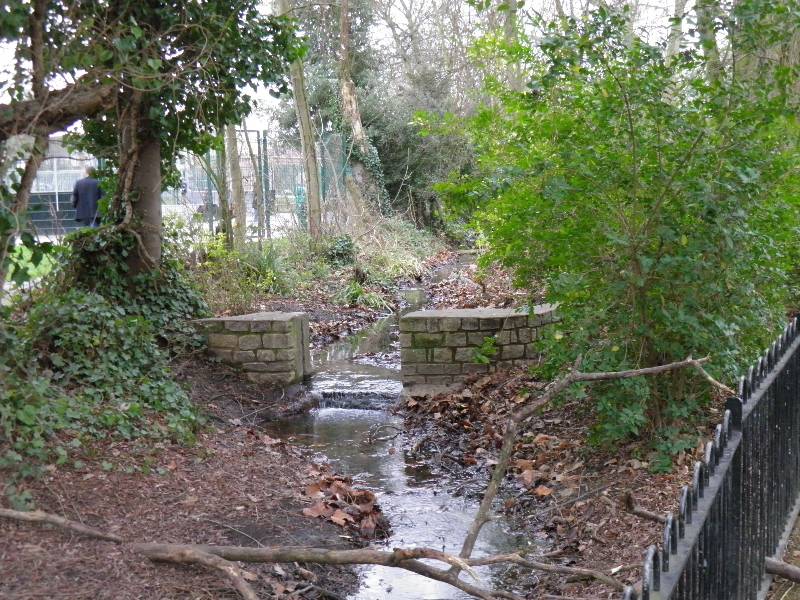
Park Bowls Club was something of a diversion. This along with the neighbouring park, John Innes Park and the surrounding area have quite an interesting history. And yes it is the John Innes after whom the potting compost is named.


Back on the main road we are reminded that we are in ‘Nelson’ territory with the hospital named for him destined for a makeover close to Wimbledon Chase station, which has certainly seen better days. The Dundonald Church seemed to be functioning in a former small factory building, and close by was a clear demolition site – unusually there was no clue as to the plans for what was going on behind the blue fences so perhaps this is where the ‘new’ Nelson will spring up?    

After a brief spell on the main road passing Raynes Park Library we went along the, to us, misplaced /misnamed Bushey Road (the Bushey we know is up in Hertfordshire) then crossed over Carter’s Bridge: a bit of research has revealed that this bridge was named for the seed company – Carter's Tested Seeds – which was here from 1911-1970. I suppose the clue is in the names for local areas – Worcester, Raynes and Motspur PARK, all implying a more rural and certainly horticultural heritage. I wonder if the Innes and Carters ever got together?? 

Certainly not around in their day was Shannon Corner, or not at least in its present incarnation with several layers of road and a couple of huge superstores, where of course we won more passengers. We had passed this way some 3 years ago on the 131 route, but there may well have been some new building since then. 

As before we left the big roads and returned to another block (literally 3 sides of a square) of Hail and Ride, this one through ‘West Barnes’ which seems to be an alternative name for Raynes Park, as even we knew we weren’t in the one adjacent to Putney. Unusually the bus route crosses the same line of railway via a level crossing twice in quick succession.

Motspur Park, whose main landmark seemed to be the Earl Beatty pub, really morphs into Old Malden and for a while we were back on the K1 bus route.  This stretch of the route had once had large detached homes, which in their later years were now residential homes for the elderly. Also along here a church with a fine large scallop shell which is of course the logo, if you will, for St James of Compostela. If it’s New Malden it must be the Fountain and sure enough we had swift passage past the main landmarks, and did not of course take the more obvious High Street/station route, but launched into another section of Hail and Ride in order to get to Kingston via more residential roads – solo older properties and bungalows this time.Kingston also thought this was a good area to teach children cycling road safety. 


As Jo pointed out on the previous account, crossing Kingston these K routes seem to favour the Norbiton, including the hospital, Kingston Central then Surbiton exit to places further south. On the way into the commercial heart of Kingston the bus goes along the London Road, nothing unusual there except I feel the need to mention the enormous 'fatberg' that was in the news recently as having  been found and then broken down in the sewers below here to prevent more above ground damage

London Road actually has comparatively little dense housing and quite a lot of shops and offices so I was a bit surprised it should be the perpetrator or progenitor of this anything but attractive lump of lard. However as Jo pointed out even grease and muck are subject to gravity so this was doubtless an accumulation of debris originating further up the various hills that reach ground level hereabouts. Anyway no sign of sewage thank goodness.  By now we had been underway an hour.


Kingston commerce behind us, we headed out of town, NOT via Surbiton for once, but through some random streets that had clearly been there before town planning was a glint in anyone’s eye.


 Tucked away is the Wych Elm pub,  which seems as well known locally for its plants as for its pints. Also intriguing was a large commanding building dated 1875 called The Keep around which the bus drove a curve; on the map it occupies quite a large area and it seems to have been once the home base/barracks for the Queen's Royal Surreys, a local regiment. There is a history of complaints about the poor maintenance offered to the residents as recently as 2008 but I could not establish if these properties were still with the MoD, or had been privatised – a chunk of prime real estate in the Royal Borough being something of a gold mine, I would have thought?

Talking of housing developments, we were about to enter and circulate round and through the ‘Tudor’ estate, so called not just for the pseudo Tudor beaming frequently applied but because the street names were all straight out of ‘Wolf Hall’ and the most devious plotty era of Henry VIII’s history – Cardinal Avenue, Wolsey Drive, Ann Boleyn Walk: disgraced and/or beheaded they may have been but was it a worse fate to end up as Kingston postcodes?


More recent history involves the once very busy aircraft factory that was located on this bus route (Jo spotted a little plaque with a plane on it – it looks quite modern she said ) with probably it most famous product being the Sopwiths various, as flown by the famous  World War I flying ace Snoopy 


Having strayed totally off the subject you won’t be surprised to hear that after Kingston we pretty much had the bus to ourselves and were certainly the only passengers descending at the final point in Duke’s Avenue. It is in fact only just round the back of the amazingly selective Cassel Hospital, but I will not bore you with details of that. This was a long and complex journey taking in excess of 75 minutes.